By Ishan Verma, Founder & Editor Theexamhub.in | July 1, 2026
The Ministry of Civil Aviation has achieved a major milestone with the approval of the nation’s first Private Point-in-Space helicopter procedure India has seen to date. Set to be implemented at the Undavalli Heliport in Andhra Pradesh, this satellite-based system will transform regional connectivity. Developed by the Airports Authority of India (AAI) and approved by the Directorate General of Civil Aviation (DGCA), this advanced system introduces precise instrument landing protocols without relying on expensive ground-based navigation hardware, significantly improving flight safety during adverse weather.
This development marks a transition in India’s helicopter operations, moving from visual flight rules (VFR) to structured instrument flight rules (IFR) even at small, remote helipads. It aligns the national civil aviation ecosystem with global best practices and sets the stage for technology-driven aviation expansion.
Key Benefits of the Point-in-Space helicopter procedure India
- All-Weather Operations: Enables helicopters to land safely during low visibility, rain, and heavy fog.
- Satelite-Based Navigation: Utilizes advanced global positioning systems and Performance-Based Navigation (PBN) instead of ground-based landing systems.
- No Ground Infrastructure Required: Eliminates the need for expensive ground-based Instrument Landing Systems (ILS) at remote helipads.
- Safety Enhancement: Aligns helicopter flight paths with the International Civil Aviation Organization (ICAO) safety standards.
- Multi-Sector Utility: Supports emergency medical services (EMS), disaster relief, regional tourism, and offshore oil and gas transport.
What is a Point-in-Space (PinS) Procedure?
The introduction of the Point-in-Space helicopter procedure India marks a major shift in how helicopters navigate complex terrains. Traditionally, helicopters rely on visual navigation, which means flights are often canceled or delayed during bad weather. A PinS procedure uses satellite navigation to guide a helicopter along a highly precise, pre-programmed three-dimensional path to a specific “Point-in-Space” near the heliport.
Once the helicopter reaches this designated point, the pilot transitions to visual flight rules (VFR) to perform the final landing. This hybrid approach allows safe operations in rugged, remote, or urban locations where installing traditional ground-based navigation aids—like Doppler Very High Frequency Omnidirectional Range (DVOR) or landing beacons—is physically or financially impractical.
To read more about civil aviation safety guidelines and regulatory structures, visit the official portal of the Directorate General of Civil Aviation (DGCA).
Strategic Impact: The Undavalli Heliport Approval
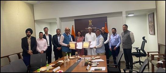
With the approval of the Point-in-Space helicopter procedure India will witness a major modernization of its regional transport systems. Spearheaded by Union Minister for Civil Aviation, Shri Ram Mohan Naidu, the Undavalli Heliport in Andhra Pradesh served as the pioneer site for this technical certification. The success of this private helipad project provides a model for other state governments and private operators to upgrade their infrastructure.
Minister Naidu noted that the introduction of PinS is part of a broader plan to build a technology-driven, globally benchmarked helicopter ecosystem. He highlighted that the ministry recently completed the first phase of this year’s Char Dham helicopter operations without any incidents, supported by upgraded navigation systems, showing that safety remains the top priority in aviation planning.
To view flight navigation projects and airport development programs across the country, visit the official Airports Authority of India (AAI) Portal.
Integrating with GAGAN and Performance-Based Navigation
By expanding the Point-in-Space helicopter procedure India is aligning its transport networks with advanced domestic satellite programs. Just last week, the aviation ministry demonstrated the country’s first indigenous GAGAN-based precision approach by a commercial aircraft. GAGAN (GPS Aided GEO Augmented Navigation) is an Indian space-based augmentation system developed jointly by ISRO and AAI.
Integrating PinS with Performance-Based Navigation (PBN) and GAGAN allows for highly accurate flight path planning. This reduces fuel consumption, minimizes flight delays due to weather, and improves airspace capacity. For emergency medical services and disaster response operations, having an all-weather helicopter network is crucial for saving lives during the critical “golden hour” of medical emergencies.
Relevance for UPSC and State PSC Aspirants
For candidates preparing for civil services, the Point-in-Space helicopter procedure India represents an important case study on infrastructure development, technology indigenization, and regional connectivity. Candidates can explore more policy updates in our National News and Infrastructure Section.
UPSC Civil Services Examination (CSE) Syllabus
- GS Paper III (Infrastructure & Economy): Infrastructure (Airports, Helipads, Regional Connectivity Scheme – UDAN); growth and development of the civil aviation sector.
- GS Paper III (Science & Technology): Indigenization of technology and developing new technology; space-based navigation systems (GAGAN, GPS, NaVIC).
State PSC (APPSC/CGPSC) Syllabus
- Regional Development and Connectivity: Development of state helipads, disaster management preparation, and emergency medical corridors in Andhra Pradesh.
- Science and Information Technology: Use of satellite-based data systems in public administration, land-use mapping, and transport coordination.
Quick Revision Table: Point-in-Space Helicopter System
| Key Parameter | System and Project Details |
|---|---|
| Aviation Milestone | First Private Point-in-Space helicopter procedure India has approved |
| Implementing Location | Undavalli Heliport, Andhra Pradesh, India |
| Developed By | Airports Authority of India (AAI) |
| Approved By | Directorate General of Civil Aviation (DGCA) |
| Navigation Standards | Performance-Based Navigation (PBN) & GAGAN (ICAO Compliant) |
| Primary Target Sector | Emergency medical services, disaster relief, tourism, and corporate aviation |
Frequently Asked Questions (FAQs)
1. What is the newly approved Point-in-Space helicopter procedure India?
It is India’s first satellite-based instrument approach procedure for helicopter operations. It allows helicopters to perform precise, safe instrument landings at helipads that do not have traditional ground-based landing infrastructure.
2. Where was the first Point-in-Space helicopter procedure India implemented?
The first PinS procedure was developed and approved for the Undavalli Heliport in Andhra Pradesh, working in coordination with the state government and central aviation agencies.
3. How does the PinS procedure improve flight safety?
The PinS procedure uses GPS and satellite data to guide helicopters along a precise 3D flight path during bad weather, fog, or heavy rain, reducing the risk of accidents caused by low visibility.
4. What is GAGAN, and how does it relate to this aviation update?
GAGAN (GPS Aided GEO Augmented Navigation) is India’s indigenous satellite-based augmentation system. The PinS procedure leverages these satellite signals to achieve high navigation accuracy without relying on ground-based hardware.
5. Which organizations collaborated to achieve this milestone?
The project was successfully completed through coordination between the Airports Authority of India (AAI), the Directorate General of Civil Aviation (DGCA), and the Ministry of Civil Aviation.
Conclusion
The successful adoption of the Point-in-Space helicopter procedure India is establishing a modern, technology-driven helicopter ecosystem. By replacing traditional, expensive ground equipment with advanced satellite-based navigation like GAGAN and PBN, India is making air transport safer and more accessible. As this system is expanded to other regions, it will improve national emergency medical services, disaster response capabilities, and remote connectivity, supporting the country’s development as a leader in modern aviation technologies.